Cunninghams Gap
Construction Surveying Support – McIlwain Civil Engineering
Project Location: Cunningham’s Gap, QLD
Project Value: $85m
Project Engagement: 2024 – 2025
project gallery
Project Overview
The Cunninghams Gap Reconstruction Project is restoring a two-kilometre section of the Cunningham Highway that was extensively damaged by severe bushfires in 2019. Situated within the Main Range National Park at an elevation of nearly 800 metres, the highway passes between the peaks of Mount Cordeaux and Mount Mitchell and serves as a key national freight route linking Brisbane and the Darling Downs region. Delivered by McIlwain Civil Engineering for TMR, the project includes construction of seven retaining walls on the downslope, four soil nail walls at the crest, installation of 20,000 square metres of rockfall protection mesh, over one kilometre of rock catch fencing, emergency stopping bays, pavement reconstruction, road grade reduction at the crest, and wide centre line treatments. The project is jointly funded by the Australian and Queensland governments through the Disaster Recovery Funding Arrangements and is expected to be complete in 2027.
RCS Scope
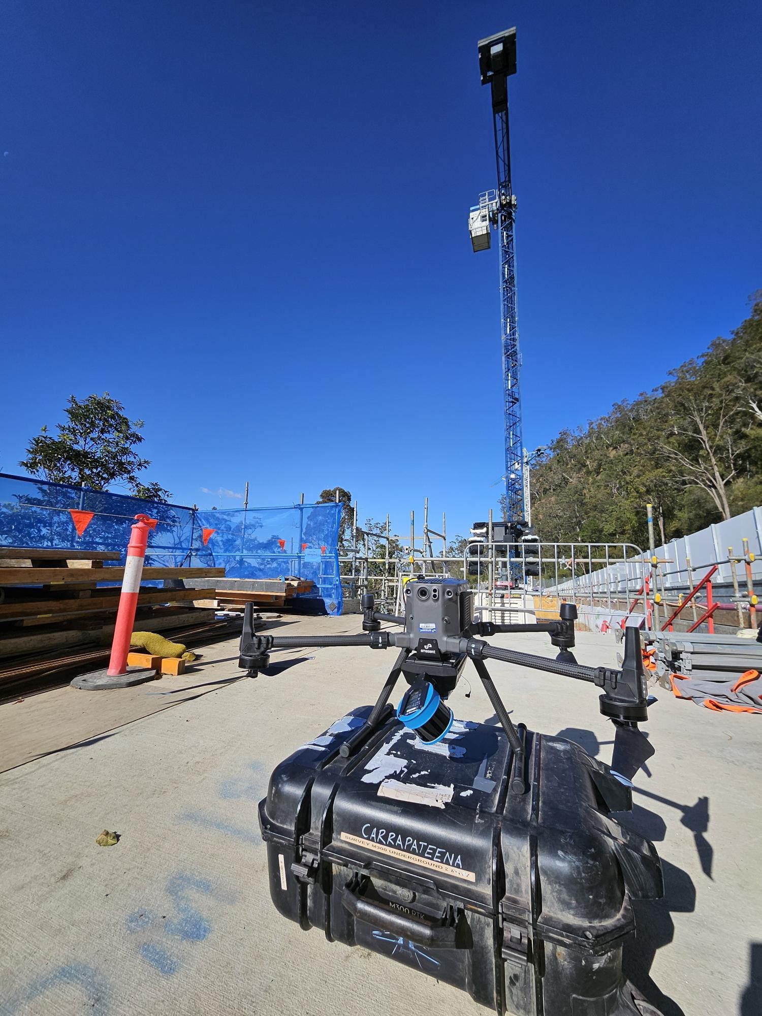
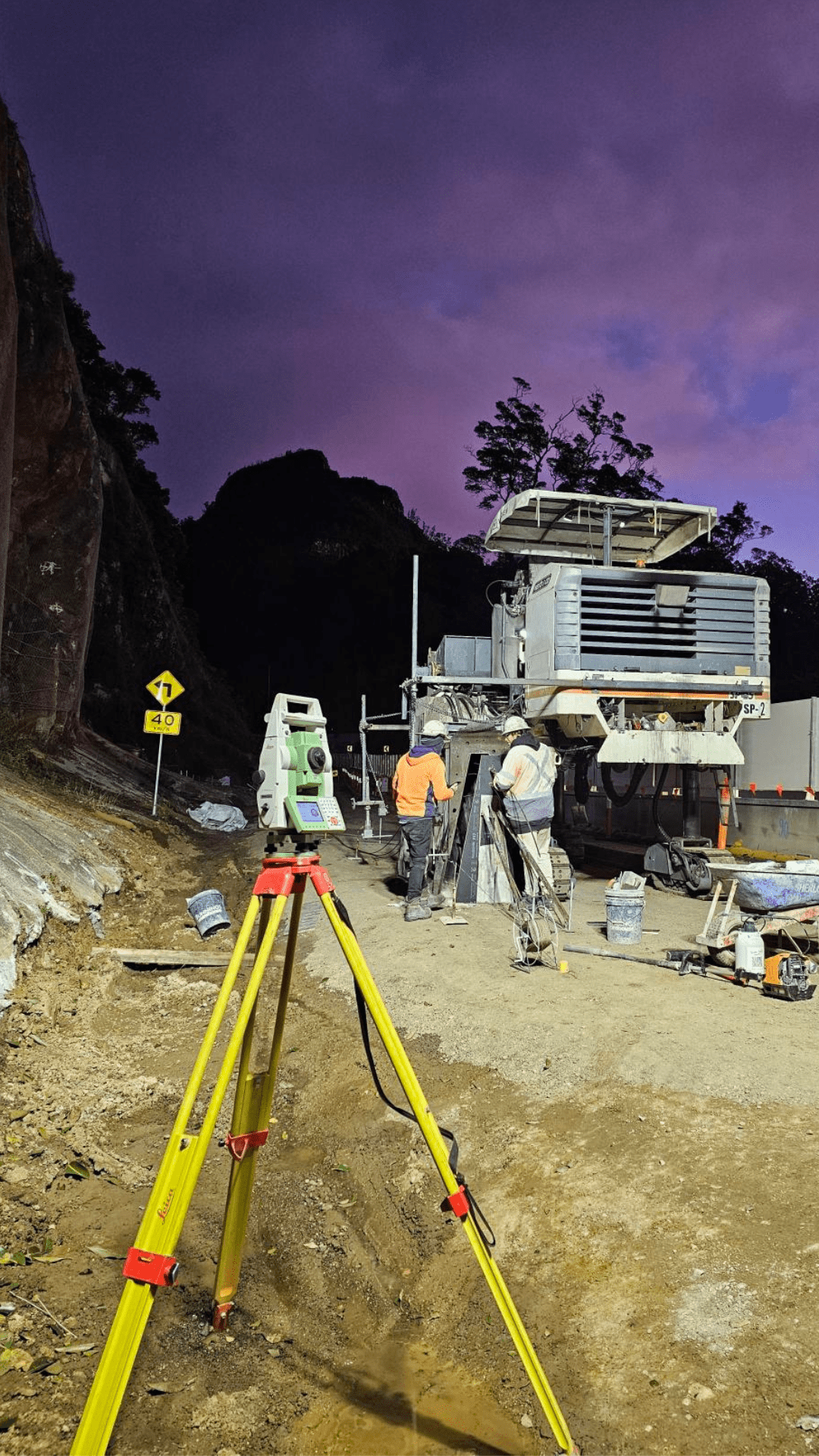
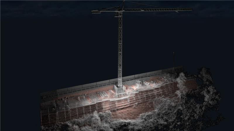
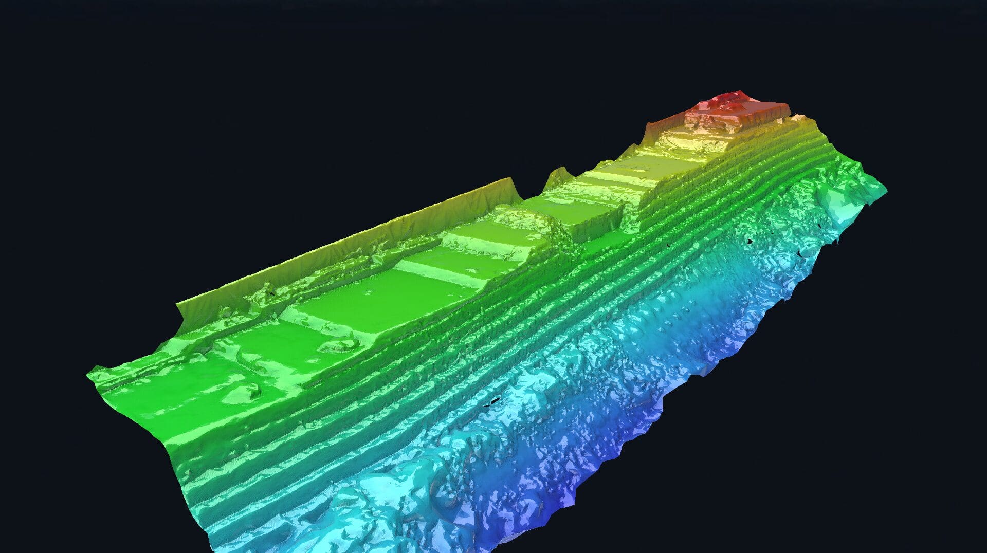
Road & Civil Surveys provided survey support across the reconstruction program, with 1–2 surveyors deployed to this remote regional Queensland location. Scope included retaining wall set-out and surveys, earthworks and pavement works, drainage infrastructure, rockfall protection infrastructure surveys, and road realignment and geometry. RCS established and maintained the project control network in steep and challenging terrain, provided data calculations and EOM reporting, and delivered 3D laser scanning to capture complex rockface geometry and UAV flyovers for progress documentation in hard-to-access areas. All work was carried out on a live national freight route with intermittent traffic management.
Value Driven
Cunninghams Gap presented a unique survey challenge — steep, complex terrain on a mountain pass within a national park, with construction activity above and below the road simultaneously. Accurate survey in these conditions demanded careful control network design and field methodology adapted to the site’s topography. 3D scanning captured the irregular rockface geometry that conventional survey methods would struggle to define with sufficient detail, supporting the design and verification of rockfall protection systems and retaining walls. UAV flyovers provided efficient progress documentation across areas that were difficult or unsafe to access on foot. Flexible deployment to a remote regional Queensland location — well outside the typical south-east Queensland corridor — demonstrated RCS’s willingness and ability to mobilise where the work demands. Cunninghams Gap was RCS’s first project with McIlwain Civil Engineering, expanding the client base in Queensland and reinforcing the company’s growing regional capability.
Services Delivered
- Construction surveying for retaining walls, earthworks, pavements, and drainage
- Rockfall protection infrastructure survey support
- Road realignment and geometry surveys
- Control network establishment and maintenance in steep terrain
- 3D laser scanning for rockface geometry capture
- UAV flyovers for progress documentation
- Data calculations and EOM reporting
- Verification and as-built surveys