Redbank Range Railway Tunnel Scan
Project Location: Picton, NSW
Service: 3D Laser Scanning | Data Modelling
project gallery
Project Overview
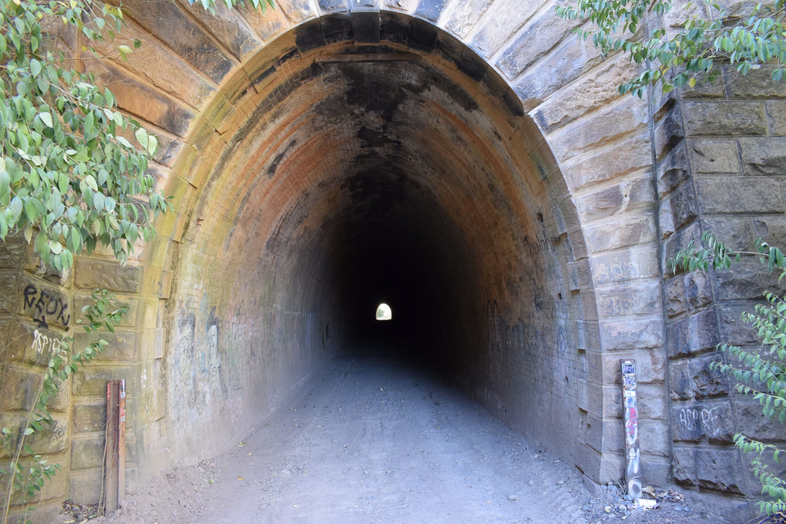
The Redbank Range Railway Tunnel at Picton, commonly known as the Mushroom Tunnel, is historically significant as the first railway tunnel used by the NSW Railways. Opened in 1867, the 180-metre single-track structure is a fine example of 1800s stonemasonry and engineering, forming part of the original Great Southern Railway. The tunnel was closed to rail traffic in 1919 and subsequently used for military storage during World War II before being repurposed for commercial mushroom growing.
Due to ongoing structural deterioration and restricted public access, accurate spatial data was required to inform a heritage condition assessment, support engineering review, and guide future conservation and remediation planning. The project required a non-intrusive, high-accuracy capture approach suitable for a confined, unlit environment with standing water, uneven ground, and no available power or lighting.
The Road & Civil Solution
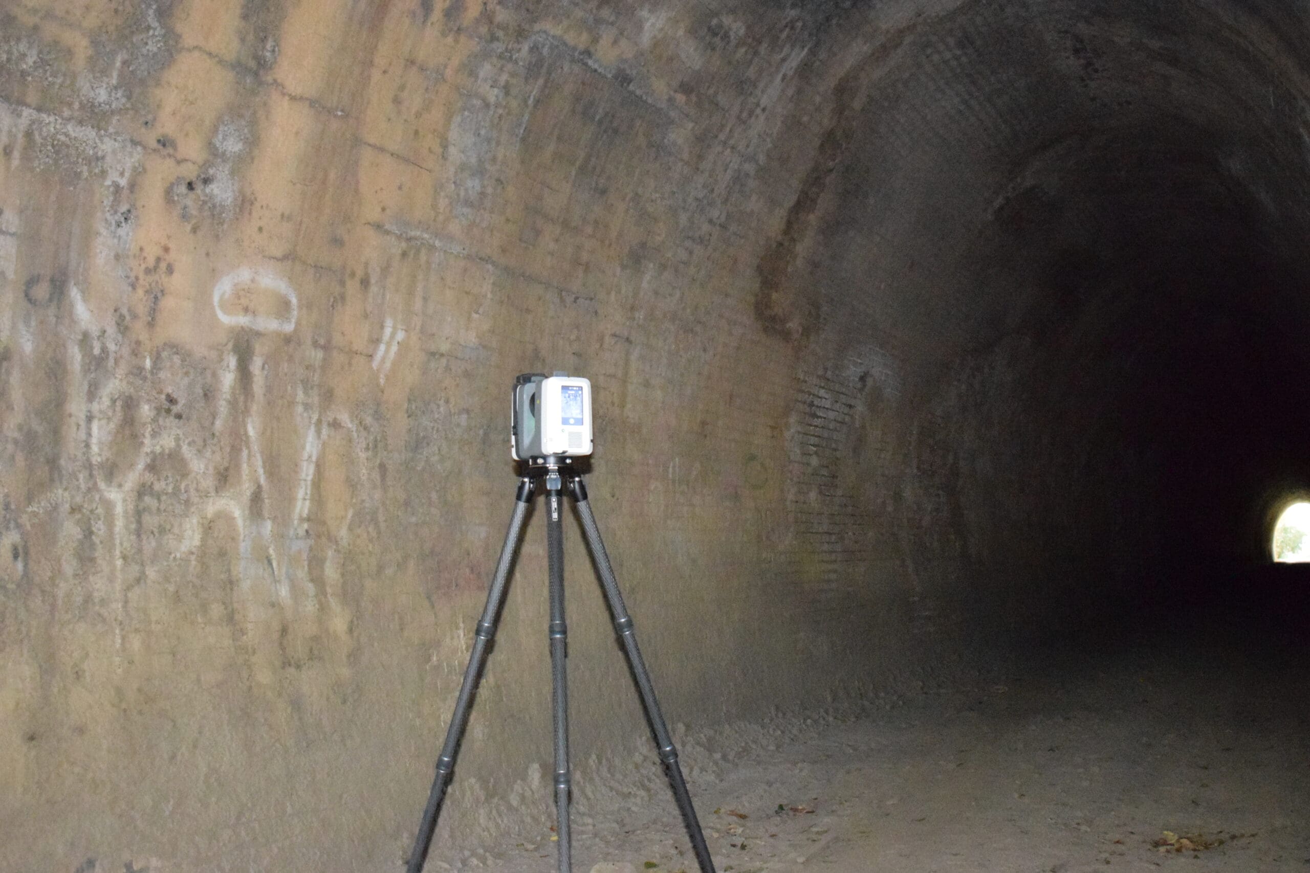
Road & Civil Surveys mobilised a specialist scanning team to site with terrestrial laser scanning equipment and battery-powered LED lighting to capture the full tunnel geometry. Survey control was established to MGA2020 Zone 56 using GNSS observations tied to permanent survey marks, with all scan data registered and coordinated to a unified project datum.
A total of 47 scan positions were completed across two field days, achieving full coverage of the tunnel interior, both portal faces, and the immediate approach cuttings. The capture included the arched brick lining, portal stonework, drainage channels, and all areas of visible structural distress including spalling, cracking, mortar loss, and water ingress.
All work was conducted using non-contact, non-intrusive methods in accordance with heritage requirements — no targets were fixed to the structure and no physical marks were made on any masonry or stonework. The team operated under confined space protocols including atmospheric monitoring, communications plans, and buddy systems throughout.
The registered point cloud was processed, quality-checked, and delivered as a coordinated dataset with cross-sections extracted at 2-metre intervals, longitudinal profiles along the crown, invert, and spring lines, and a clearance and deformation analysis comparing the as-built geometry against nominal tunnel profiles.
Key Outcomes for the Client
A complete, high-accuracy 3D spatial record of the tunnel was delivered, providing the project team with reliable data to support informed decision-making on the future of the asset. The point cloud and extracted deliverables enabled the heritage and engineering teams to identify and quantify areas of structural concern without the need for repeated site visits to a restricted and deteriorating environment.
The deliverables were formatted to meet the requirements of the NSW Heritage Act and were suitable for direct inclusion in heritage management plans, conservation strategies, and future design documentation. An interactive web-based viewer was also provided, allowing stakeholders to navigate the tunnel remotely and interrogate the spatial data without specialist software.
The project was delivered on program and within budget with zero safety incidents.
Project Snapshot
Tunnel Length: 180 metres Scan Positions: 47 Point Cloud Density: ~3mm at 10m range Registration Accuracy: ≤2mm cloud-to-cloud Survey Datum: MGA2020 Zone 56 / AHD Field Duration: 2 days Processing & Delivery: 5 business days
Services Delivered
- High-definition 3D laser scanning
- Survey control and GNSS coordination
- Registered and coordinated point cloud datasets (E57, RCP, LAS)
- Cross-section extraction at 2m intervals
- Longitudinal profile extraction (crown, invert, spring lines)
- Clearance and deformation analysis
- Heritage condition documentation
- Interactive web-based viewer (TruView)
- Project summary report