Bridge Aerial Inspection and LiDAR Survey
Project Location: Douglas Park, NSW
Service: Aerial LiDAR | Asset Inspection | UAV Survey
project gallery
Project Overview
Road & Civil Surveys was engaged to undertake an asset inspection and aerial LiDAR survey of the Douglas Park twin bridges, which carry the M31 Hume Motorway over the Nepean River gorge in the Wollondilly Shire, approximately 80 kilometres south-west of Sydney.
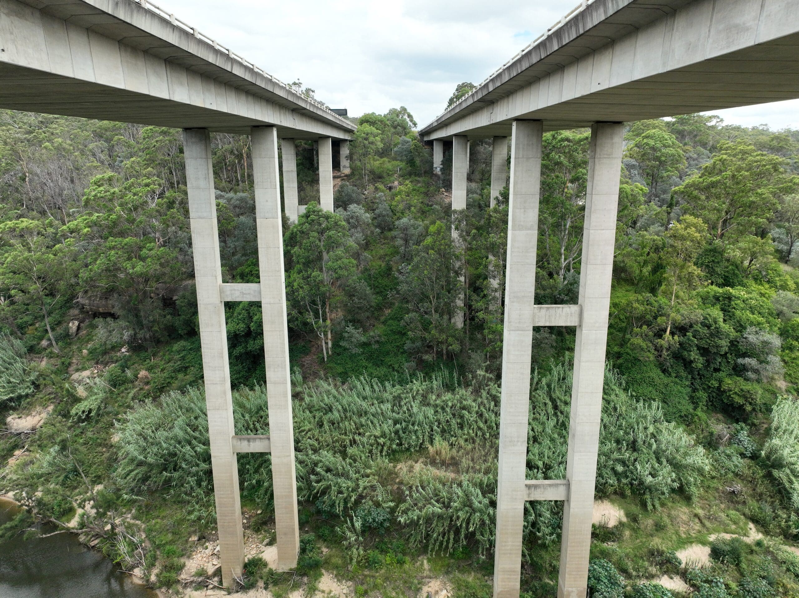
The Douglas Park bridges are among the most significant road bridge structures in New South Wales. Constructed in 1980 as part of the extension of the Hume Highway from Campbelltown to Yanderra, the twin bridges span approximately 280 metres across the deeply incised Nepean River gorge. The bridge deck sits up to 68 metres above the river, supported by piers ranging from 10 to 55 metres in height, making them one of the tallest bridge structures in the state.
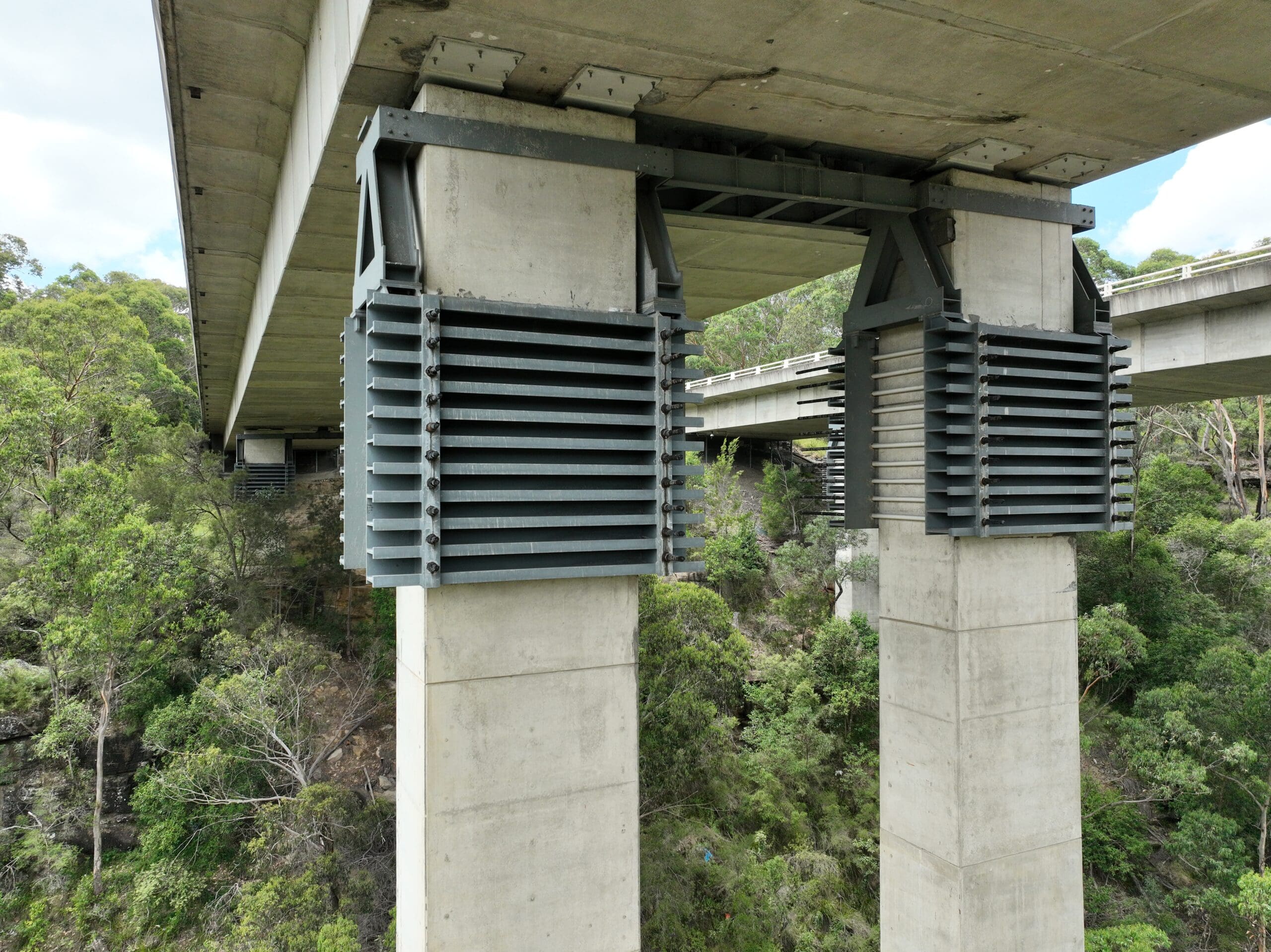
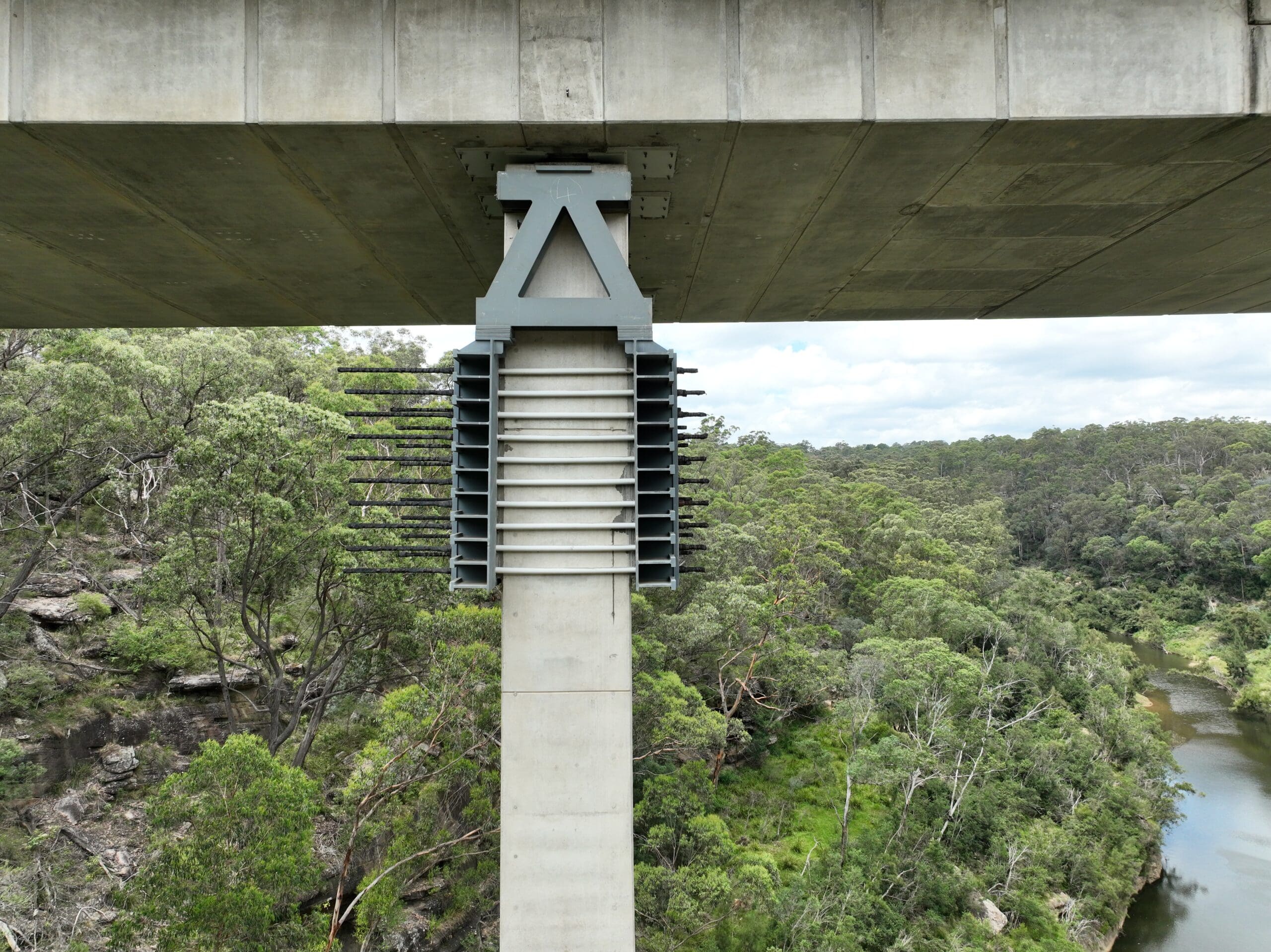
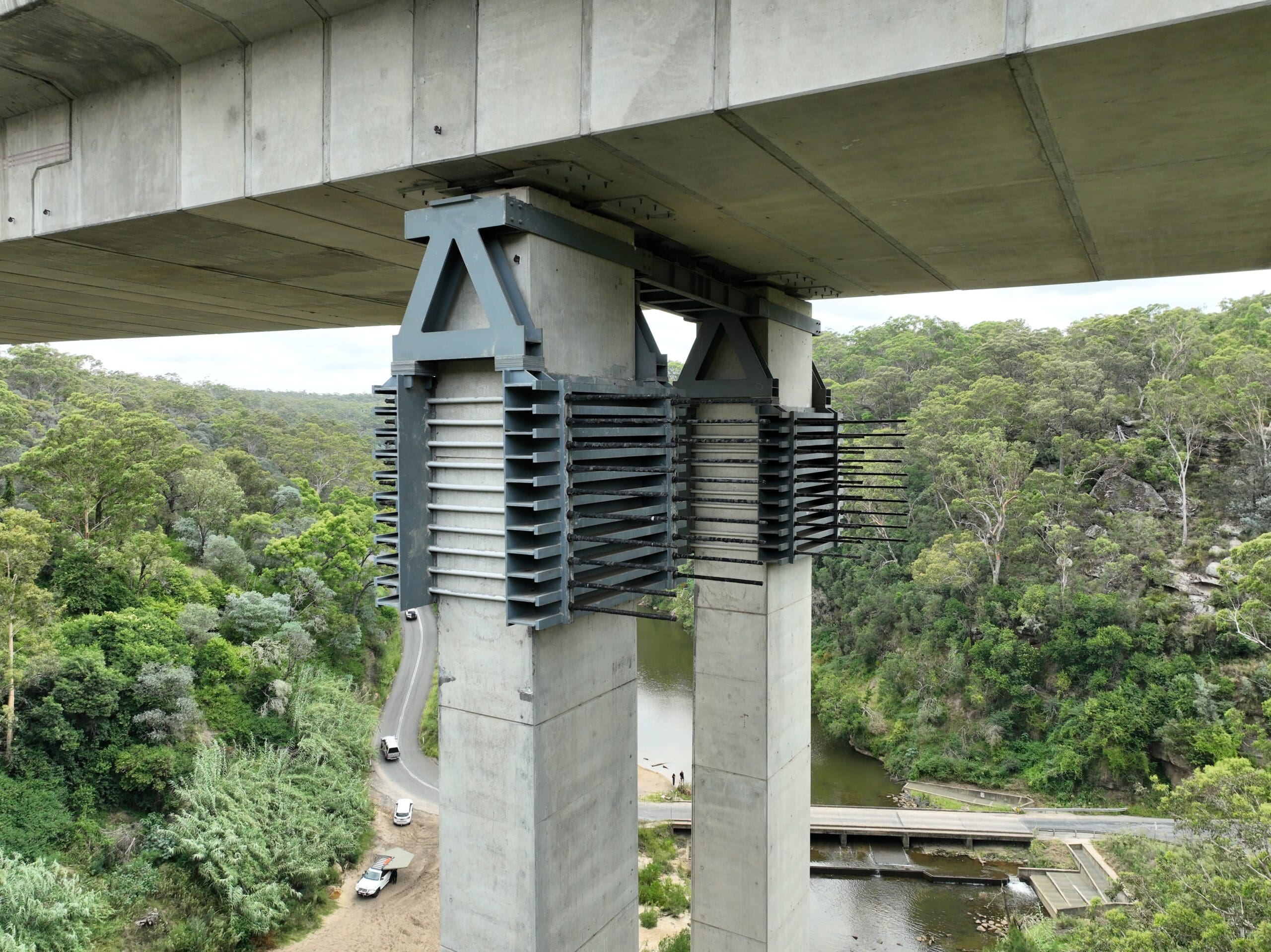
The bridges have a complex structural history. Longwall coal mining in the area has caused ground subsidence beneath the structures, with the twin bridges recording horizontal movements of up to 60mm. In 2007, the bridges were temporarily closed to traffic and hydraulically repositioned. Additional structural bracing was subsequently installed to the piers to manage ongoing subsidence risk. This history of ground movement makes regular, high-quality asset inspection critical to maintaining the structural integrity and safe operation of one of the busiest freight corridors in Australia.
The Road & Civil Solution
The extreme height, steep terrain and limited ground access within the Nepean River gorge made traditional inspection and survey methods impractical. Road & Civil Surveys deployed aerial LiDAR and UAV-based inspection techniques to capture comprehensive structural and spatial data without requiring road closures, rope access or scaffolding.
- Aerial LiDAR was used to capture a high-density point cloud of the full bridge structures, piers, abutments and surrounding gorge terrain.
- UAV-mounted sensors provided close-range inspection-grade imagery of the bridge deck, pier faces, bearings and structural bracing — areas that would otherwise require traffic management, under-bridge inspection units or rope access.
- All survey data was tied to high-accuracy ground control, ensuring the deliverables are spatially referenced and compatible with existing asset management systems.
- The combination of LiDAR and visual inspection data provides both geometric accuracy and condition assessment in a single mobilisation.
Key Outcomes
Safe Access to Inaccessible Structure — Aerial methods eliminated the need for rope access, under-bridge units or lane closures on one of Australia’s busiest motorways.
Full Structural Coverage — Piers up to 55 metres tall and the underside of the bridge deck were captured without scaffolding or traffic disruption, including the additional bracing installed following subsidence events.
Subsidence Monitoring Support — High-accuracy spatial data supports ongoing monitoring of structural movement related to historic and potential future ground subsidence from mining activity in the area.
Single Mobilisation Efficiency — Both geometric survey data and visual condition inspection imagery were captured in a single site visit, reducing cost and time compared to separate inspection and survey programs.
Project Snapshot
- 280m Approximate Bridge Span
- 68m Maximum Height Above River
- 0 Road Closures Required
Services Delivered
- Aerial LiDAR survey
- UAV-based close-range asset inspection
- High-accuracy ground control establishment
- High-density point cloud capture and processing
- Structural condition imagery
- Georeferenced deliverables for asset management