Nepean and Lansvale Bridge survey
Project Location: Penrith and Lansvale NSW
Service: 3D Laser Scanning | Bridge Survey | Data Modelling
project gallery
Project Overview
Road & Civil Surveys was engaged to capture and model two heritage-listed bridges in western and south-western Sydney — the Victoria Bridge (Nepean Bridge) at Penrith and the Lansdowne Bridge at Lansvale — as part of a bearing maintenance and replacement program.
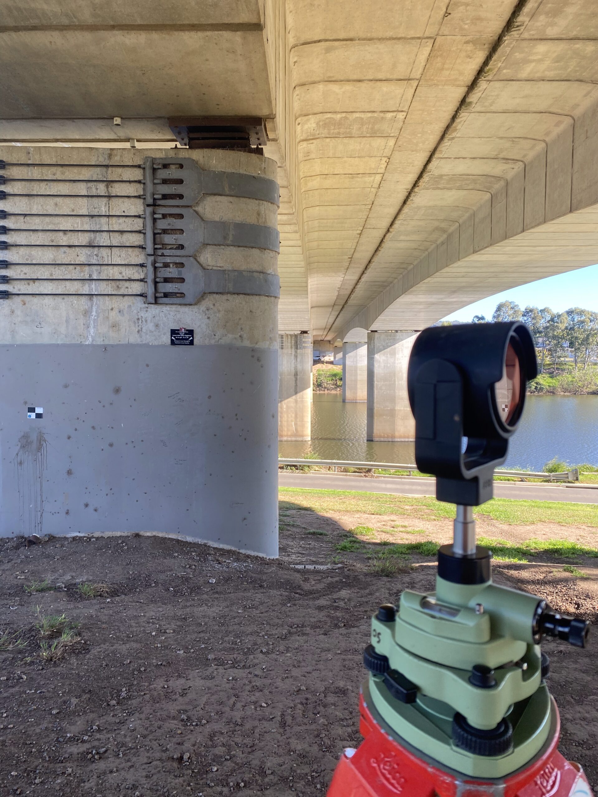
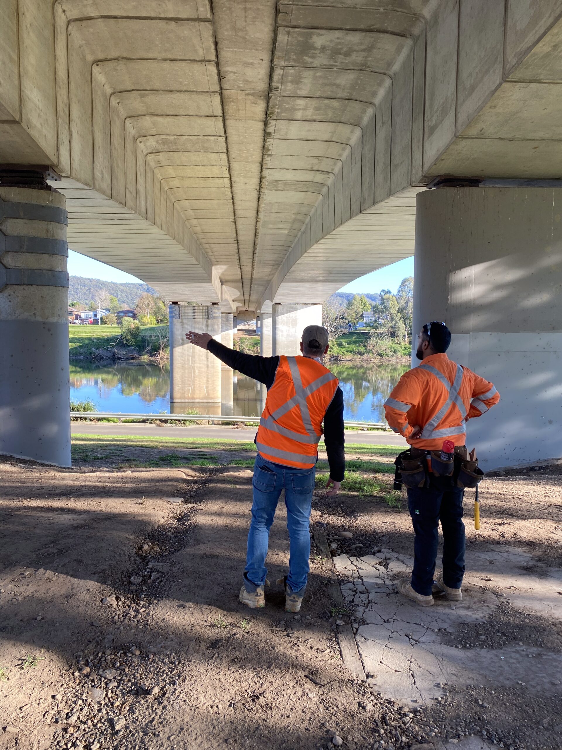
The Victoria Bridge at Penrith is one of Sydney’s most significant heritage structures. Completed in 1867, the wrought iron box plate girder bridge spans the Nepean River on the Great Western Highway and is listed on the NSW State Heritage Register. Originally designed to carry both rail and road traffic, the bridge was converted to road-only use in 1907 and today carries approximately 25,000 vehicles per day. It remains the oldest surviving crossing of the Hawkesbury–Nepean River.
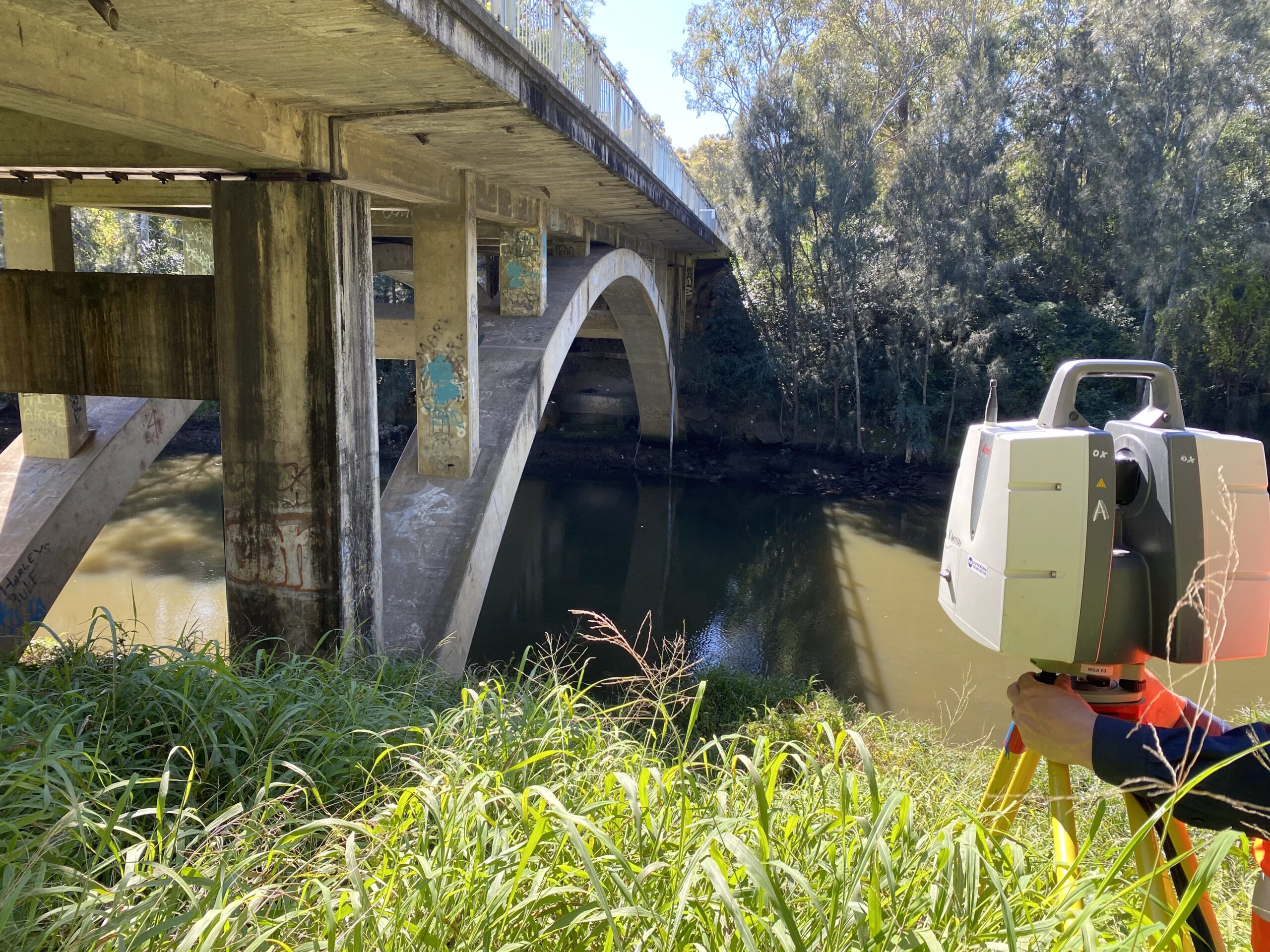
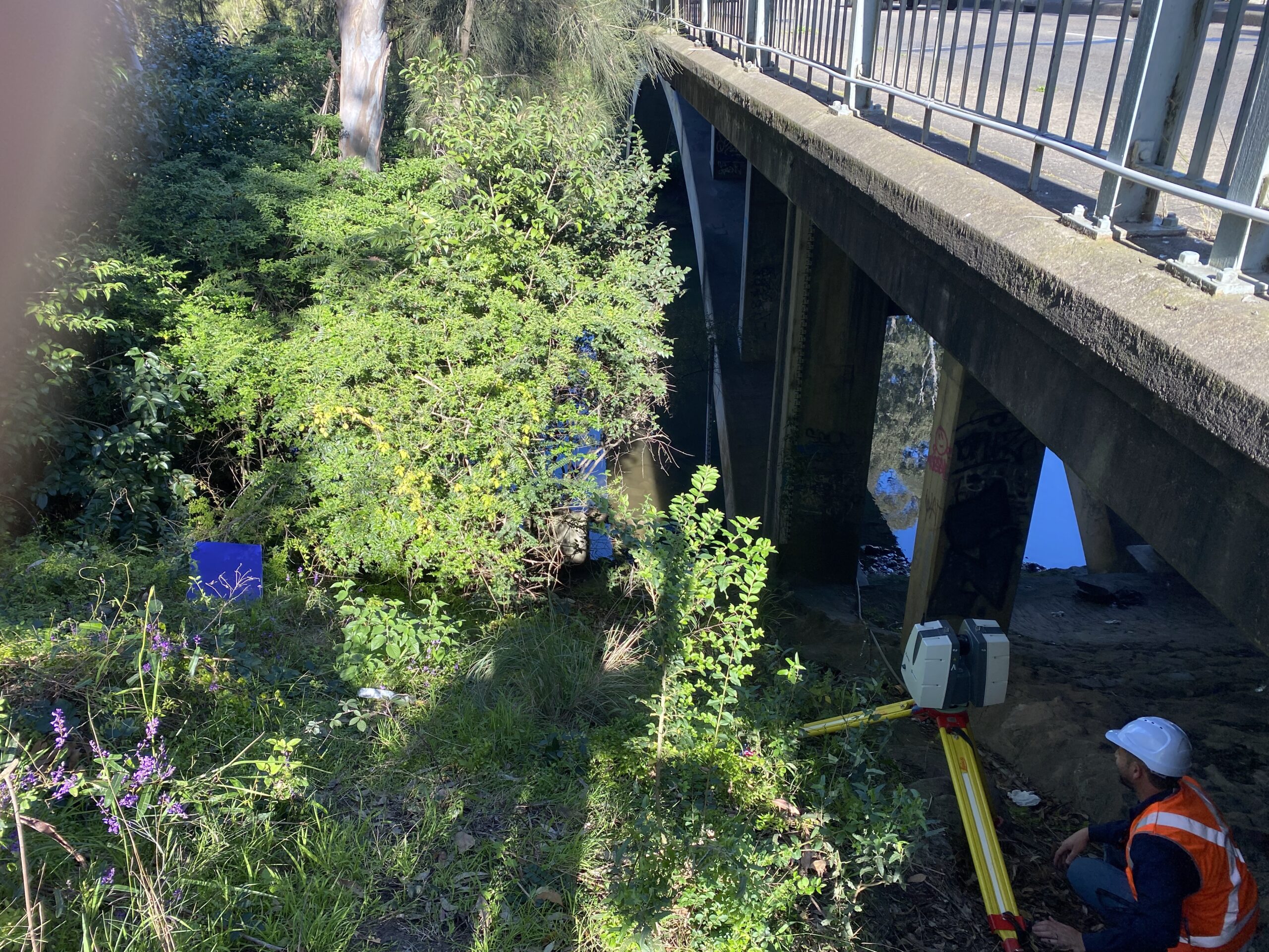
The Lansdowne Bridge at Lansvale is equally significant. Built between 1834 and 1836, it is the second-oldest surviving sandstone bridge in Sydney and carries eastbound traffic on the Hume Highway across Prospect Creek. The bridge features the largest span of any surviving masonry arch in Australia and is listed on both the NSW State Heritage Register and the former Register of the National Estate.
Due to the age of both bridges, differential shrinkage along each structure has caused the steel roller bearings to approach the maximum extension across their bearing plates. To inform the maintenance and replacement of these critical components, a precise 3D model of both bridges was required, including each individual roller bearing and bearing plate.
The Road & Civil Solution
Access from the top of both bridges was limited, and road closures or traffic disruptions were not feasible given the volumes of traffic each bridge carries daily.
Road & Civil Surveys recommended high-definition laser scanning as the most efficient and accurate methodology — enabling comprehensive data capture without impacting live traffic or requiring pedestrian management.
Our team deployed a combination of Leica P40, Leica RTC360 and RIEGL VZ-600i laser scanners, integrated with high-accuracy survey control to ensure precise georeferencing and consolidation of all data.
To achieve complete coverage of each roller bearing and bearing plate, the bridges were scanned from multiple elevations and angles. Over 100 individual scanning stations were established, with each station tied to 1-inch total station control to ensure all datasets aligned seamlessly into a single coordinated model.
The result was a dense, high-accuracy point cloud and a comprehensive 3D model delivered within two days — significantly faster and more detailed than traditional survey methods.
Key Outcomes
Zero Traffic Disruption — Both bridges were captured in full without road closures, lane restrictions or pedestrian management, maintaining uninterrupted traffic flow on the Great Western Highway and Hume Highway.
Heritage-Sensitive Approach — The non-contact laser scanning methodology ensured no physical interaction with either heritage structure, preserving the integrity of both state-listed assets.
Bearing-Level Detail — Individual roller bearings and bearing plates were modelled with sufficient accuracy to support the engineering assessment and replacement design.
Rapid Delivery — A dense, high-accuracy point cloud and comprehensive 3D model were delivered within two days, significantly faster than traditional survey methods.
Project Snapshot
- 100+ Individual Scanning Stations
- 2 Heritage-Listed Bridges Captured
- 3 Scanner Platforms Deployed (Leica P40, RTC360, RIEGL VZ-600i)
- 0 Traffic Disruptions
Services Delivered
- High-definition terrestrial laser scanning
- Multi-scanner deployment (Leica P40, Leica RTC360, RIEGL VZ-600i)
- High-accuracy survey control and georeferencing
- Multi-angle and multi-elevation capture
- Point cloud registration and processing
- 3D bridge and bearing modelling