Railway Bridge Aerial Condition Assessment
Project Location: Menangle, NSW
Service: High Res Photography | UAV Survey
project gallery
Project Overview
Road & Civil Surveys was engaged to undertake a UAV-based aerial inspection of the Menangle Railway Bridge, capturing high-resolution photography and video to support a condition assessment of one of the most historically significant rail structures in New South Wales.
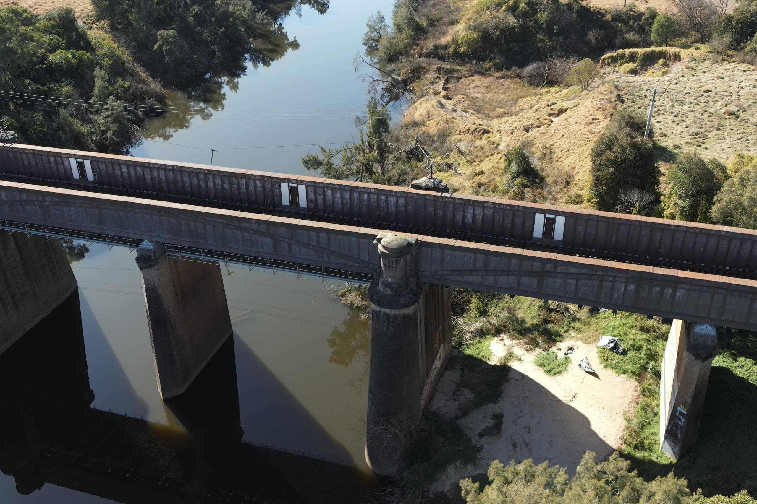
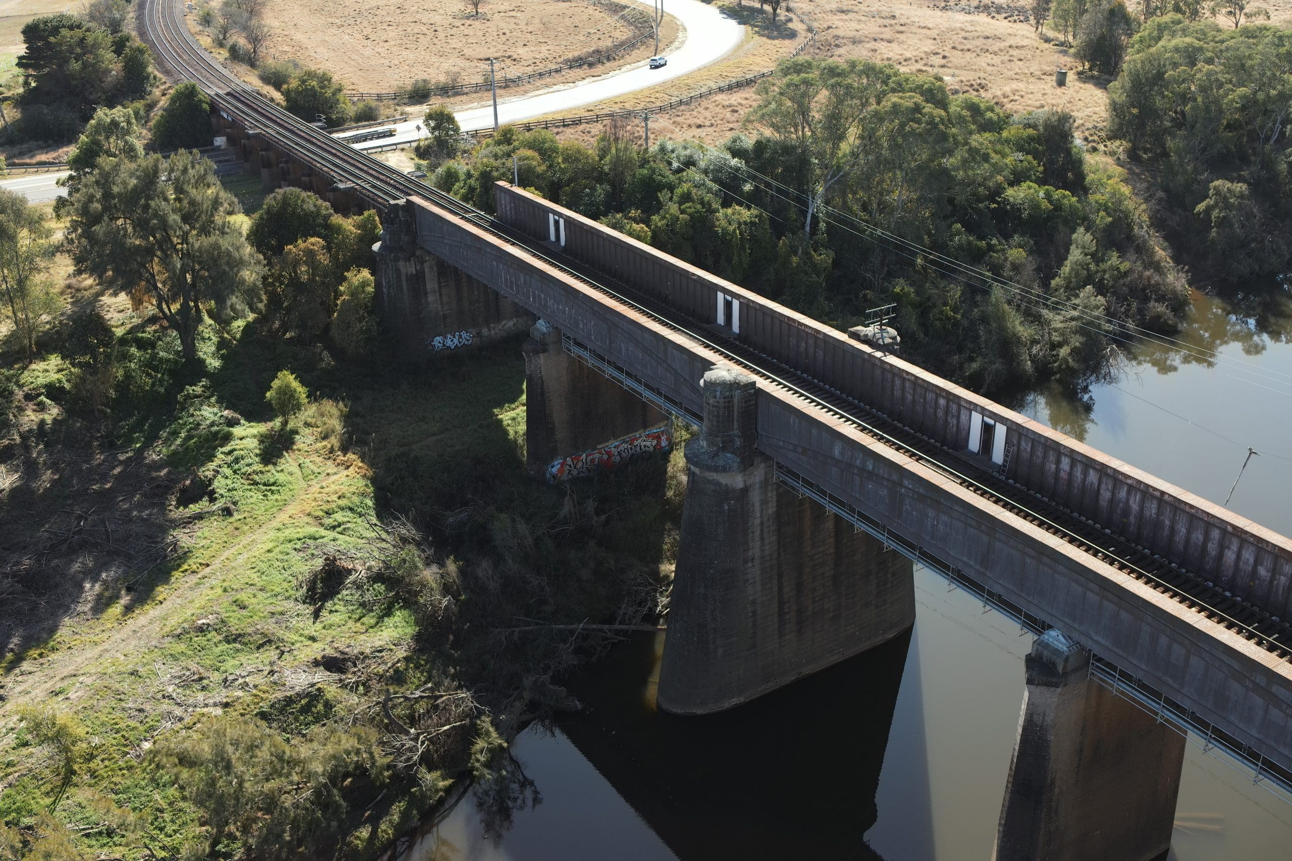
The Menangle Railway Bridge carries the Main South Line over the Nepean River between Menangle Park and Menangle stations, approximately 64 kilometres south-west of Sydney. Completed in 1863 under the direction of John Whitton — NSW Railways’ first Engineer-in-Chief — the bridge is the oldest metal railway bridge still in use in New South Wales and was the first large iron bridge constructed on the state rail network. The wrought iron superstructure was fabricated in England at the Canada Works in Birkenhead and shipped to Australia in 1861, with one of the two transport vessels wrecked shortly after leaving the Mersey — requiring replacement ironwork to be refabricated and shipped before construction could be completed.
The bridge is listed on the NSW State Heritage Register and received an Engineering Heritage Marker from Engineers Australia in 2009. The original structure comprised three 49.4-metre spans of Fairbairn-type wrought iron cellular (box) girders, continuous from abutment to abutment, supported on sandstone piers. In 1907, intermediate brick piers were added at mid-span to halve the effective span lengths and increase the bridge’s load capacity for heavier modern rolling stock. The original timber approach viaducts were replaced with steel girders in 1923. Despite its age, the bridge remains in active service on one of Australia’s primary intercity rail corridors.
The heritage status, ongoing operational use and structural age of the bridge make regular condition assessment essential. However, the bridge’s height above the Nepean River, the active rail corridor and the heritage constraints on physical access make traditional close-range inspection methods challenging, disruptive and costly.
The Road & Civil Solution
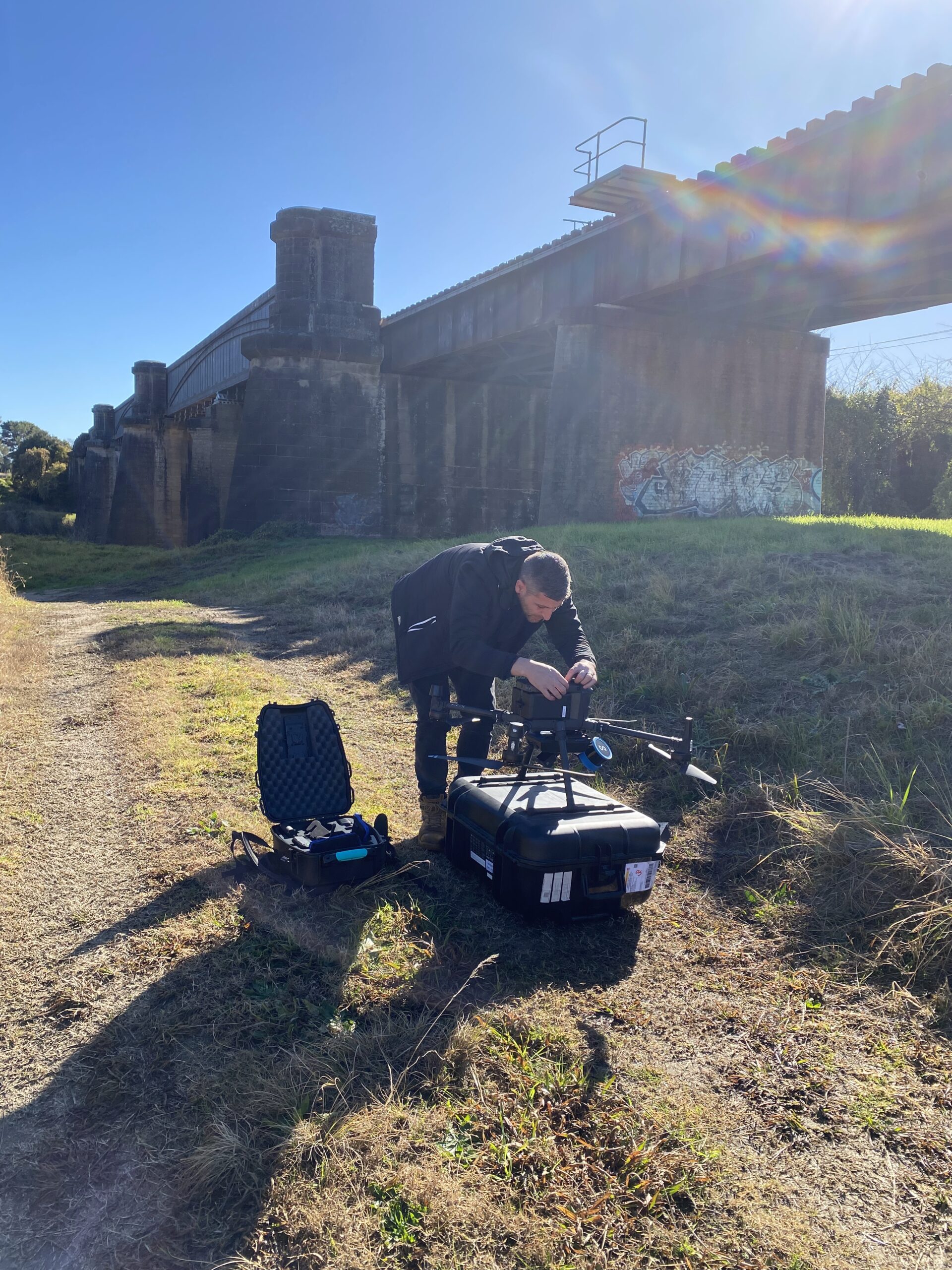
Road & Civil Surveys deployed UAV platforms to capture comprehensive aerial imagery and video of the bridge structure, providing the inspection team with detailed visual data without requiring rail possessions, scaffolding, rope access or under-bridge inspection units.
- High-resolution photography was captured of all key structural elements including the wrought iron box girders, sandstone and brick piers, bearing seats, cross girders, deck structure and approach spans. Multiple flight profiles were used to capture both wide-angle context imagery and close-range detail of specific areas of interest.
- Video footage was recorded to document the overall condition of the structure and provide the assessment team with a continuous visual record that complements the still photography, capturing surface conditions, vegetation growth, moisture patterns and areas of deterioration in a format that supports detailed review off-site.
- All imagery was captured with GPS metadata, enabling the assessment team to accurately locate and reference specific observations against the bridge structure.
- The UAV inspection was completed without any disruption to rail operations on the Main South Line.
Key Outcomes
No Rail Possession Required — Aerial inspection eliminated the need for costly and disruptive rail corridor shutdowns on an active intercity line, with all data captured while the bridge remained in full operation.
Safe Access to Heritage Fabric — UAV platforms provided close-range visual access to the 160-year-old wrought iron girders, pier faces and bearing details without physical contact with the heritage-listed structure — avoiding the risk of damage that scaffolding or climbing equipment can pose to historic fabric.
Comprehensive Visual Record — The combination of high-resolution photography and video delivered a thorough visual dataset covering the full bridge structure, supporting both the immediate condition assessment and providing a baseline record for future comparison.
Efficient Data Capture — A survey program that would traditionally require multi-day rail possessions, specialist access equipment and significant traffic management coordination was completed in a single mobilisation with no impact on rail services.
Project Snapshot
- 1863 Year of Construction
- 160+ Years In Continuous Service
- 6 Spans Across the Nepean River
- NSW State Heritage Register Listed
- 0 Disruption to Rail Operations
Services Delivered
- UAV aerial inspection
- High-resolution structural photography
- Video condition documentation
- GPS-referenced imagery capture
- Close-range detail photography of heritage fabric
- Multi-angle flight profile coverage