3D Scanning North Richmond Sewer Pump Station
Project Location: North Richmond
Service: 3D Laser Scanning
project gallery
Project Overview
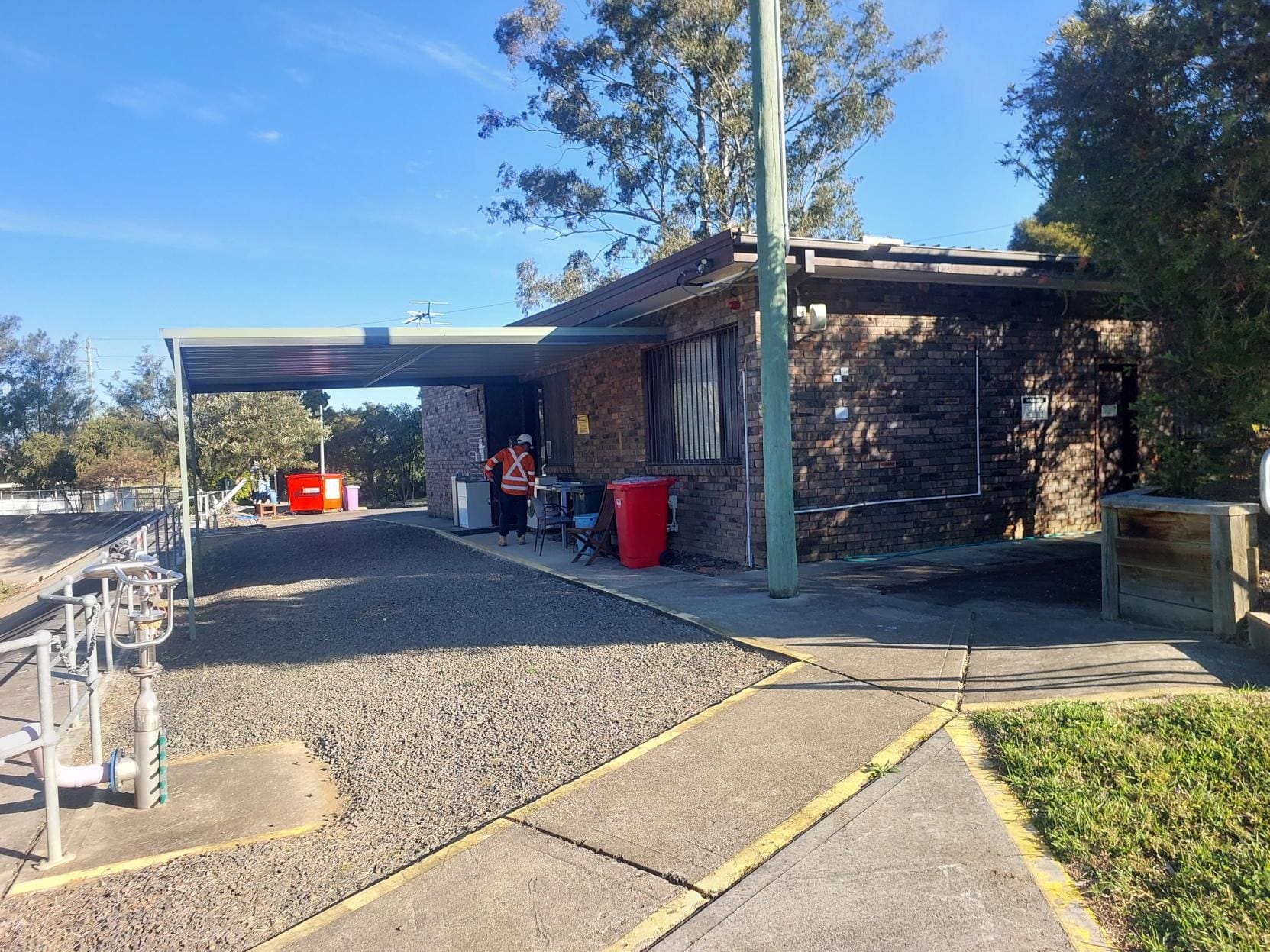
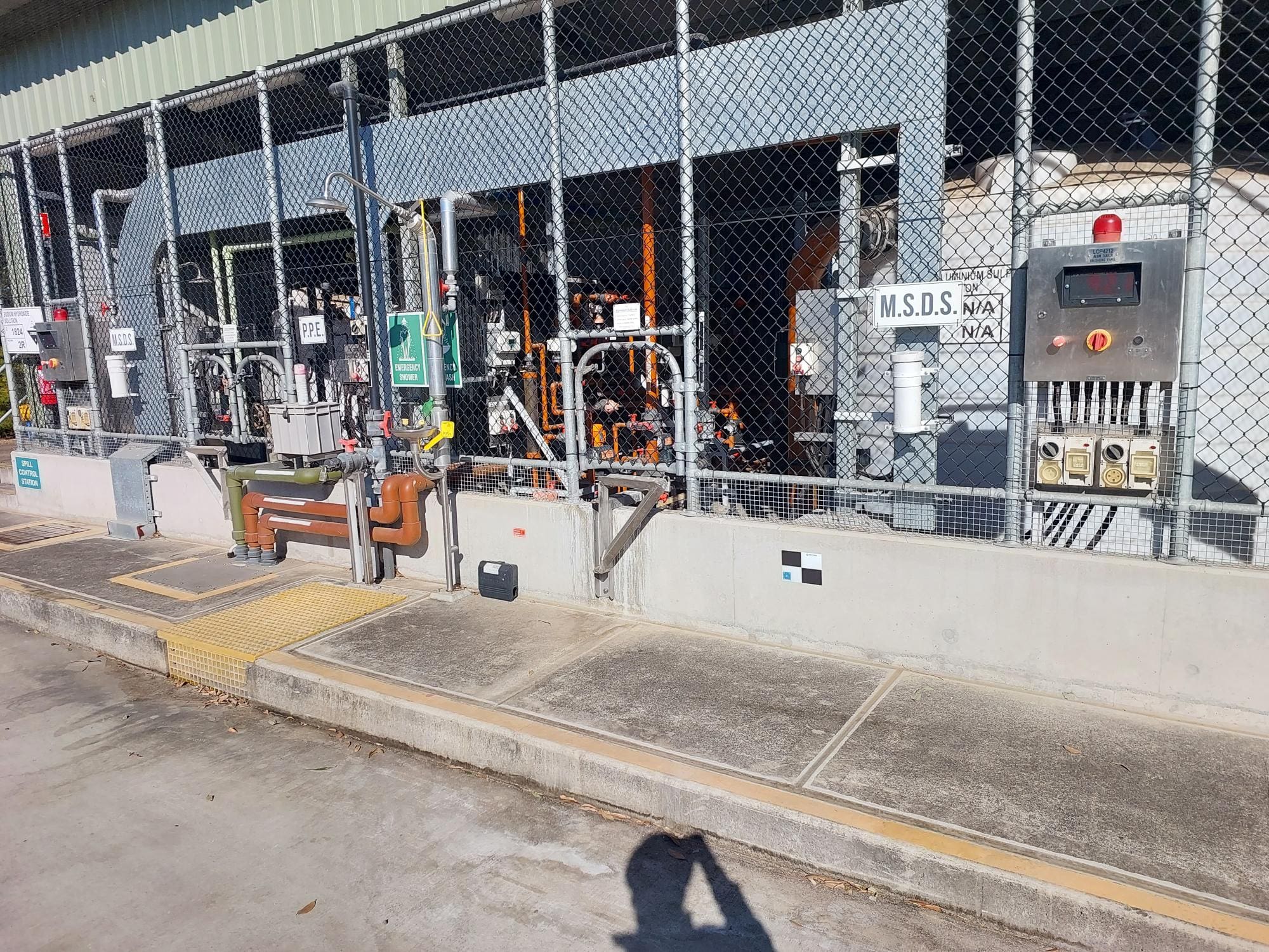
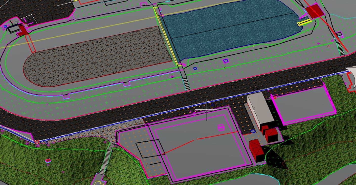
Road & Civil Surveys was engaged to produce a millimetre-accurate Revit model of the North Richmond Sewer Pump Station (SPS 0096), located in the Hawkesbury region of north-western Sydney. The as-built model was required to support the redesign and upgrade of the facility as part of a broader wastewater infrastructure program.
The North Richmond SPS is a critical component of Sydney Water’s wastewater network, servicing the North Richmond catchment within the Hawkesbury local government area. The station forms part of the $185 million Richmond System Wastewater Upgrade — a major program of works designed to future-proof wastewater services for the region’s projected 70 per cent population growth over the next 30 years.
Under this upgrade, the existing North Richmond Wastewater Treatment Plant is being decommissioned and replaced with a new, higher-capacity pump station on the same site. A new 6.9-kilometre transfer pipeline will connect the North Richmond system to the upgraded Richmond Water Resource Recovery Facility. The as-built data captured by Road & Civil Surveys was required to inform the engineering assessment, remediation scoping and detailed design of the new pump station infrastructure.
The Road & Civil Survey Solution
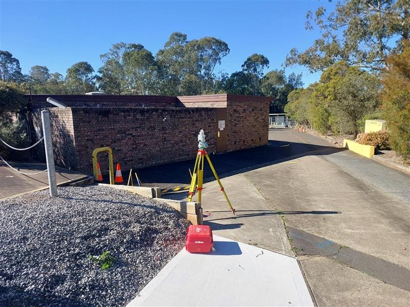
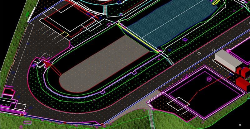
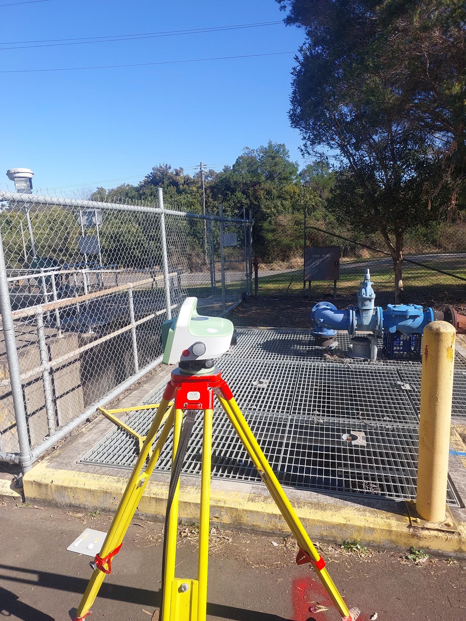
Road & Civil Surveys deployed its in-house scan-to-Revit workflow, using high-accuracy terrestrial laser scanning to capture the full extent of the pump station and surrounding site infrastructure.
- Over 250 individual laser scans were registered to a rigorous Survey Control Network, producing a single, unified point cloud of the entire site.
- External scans were captured with HDR imagery to colourise the final point cloud and support panoramic site tours in the deliverable software.
- The registered point cloud achieved an accuracy of approximately 5mm.
- Autodesk Revit was used to develop a spatially accurate 3D model through feature extraction directly from the point cloud data.
Fieldwork was completed over two days on-site with a two-person crew, minimising disruption to ongoing operations at the facility.
Key Outcomes
Rapid Field Capture — Two-day site mobilisation with a two-person crew, keeping disruption to active operations to a minimum.
Millimetre Accuracy — The final as-built model delivers millimetre-level precision, giving the design team confidence in spatial accuracy for clash detection and coordination.
Digital Twin Capability — The colourised point cloud and Revit model together function as a digital twin, supporting ongoing maintenance planning and future asset management.
Design-Ready Deliverable — The Revit model is directly usable for engineering assessment, remediation scoping and detailed design of the upgraded pump station infrastructure.
Project Snapshot
- 250+ Individual Laser Scans
- ~5mm Point Cloud Accuracy
- 4 Days On-Site Fieldwork
Services Delivered
- High-accuracy terrestrial laser scanning
- Survey control network establishment
- HDR imagery capture and point cloud colourisation
- Point cloud registration and processing
- Scan-to-Revit as-built BIM modelling
- Panoramic site tour deliverable