Large-Scale Topographic Survey for Land Development
Project Location: Lithgow, NSW
Service: Aerial LiDAR | UAV Survey
project gallery
Project Overview
Road & Civil Surveys was engaged to deliver a comprehensive topographic survey of a 100-hectare rural landholding on the outskirts of Lithgow in the NSW Central Tablelands. The survey data was required to support a Development Application lodgement with Lithgow City Council for a proposed residential subdivision and associated civil infrastructure.
Lithgow sits at approximately 950 metres elevation on the western edge of the Blue Mountains, within the Lithgow local government area. The region is experiencing steady residential growth, with council actively planning for new housing supply across a mix of residential and large-lot rural residential zones under the Lithgow Local Environmental Plan 2014. Subdivision and land development proposals in the area typically require detailed topographic data to inform lot layout, road design, stormwater management, bushfire assessment and environmental impact analysis.
The project site comprised undulating rural terrain with significant tree cover, scattered farm infrastructure, multiple drainage lines and natural grade changes of over 30 metres across the holding. Traditional ground survey across a site of this scale and terrain complexity would have required weeks of fieldwork and extensive vegetation clearing — neither practical nor cost-effective for a DA-stage deliverable.
The Road & Civil Solution
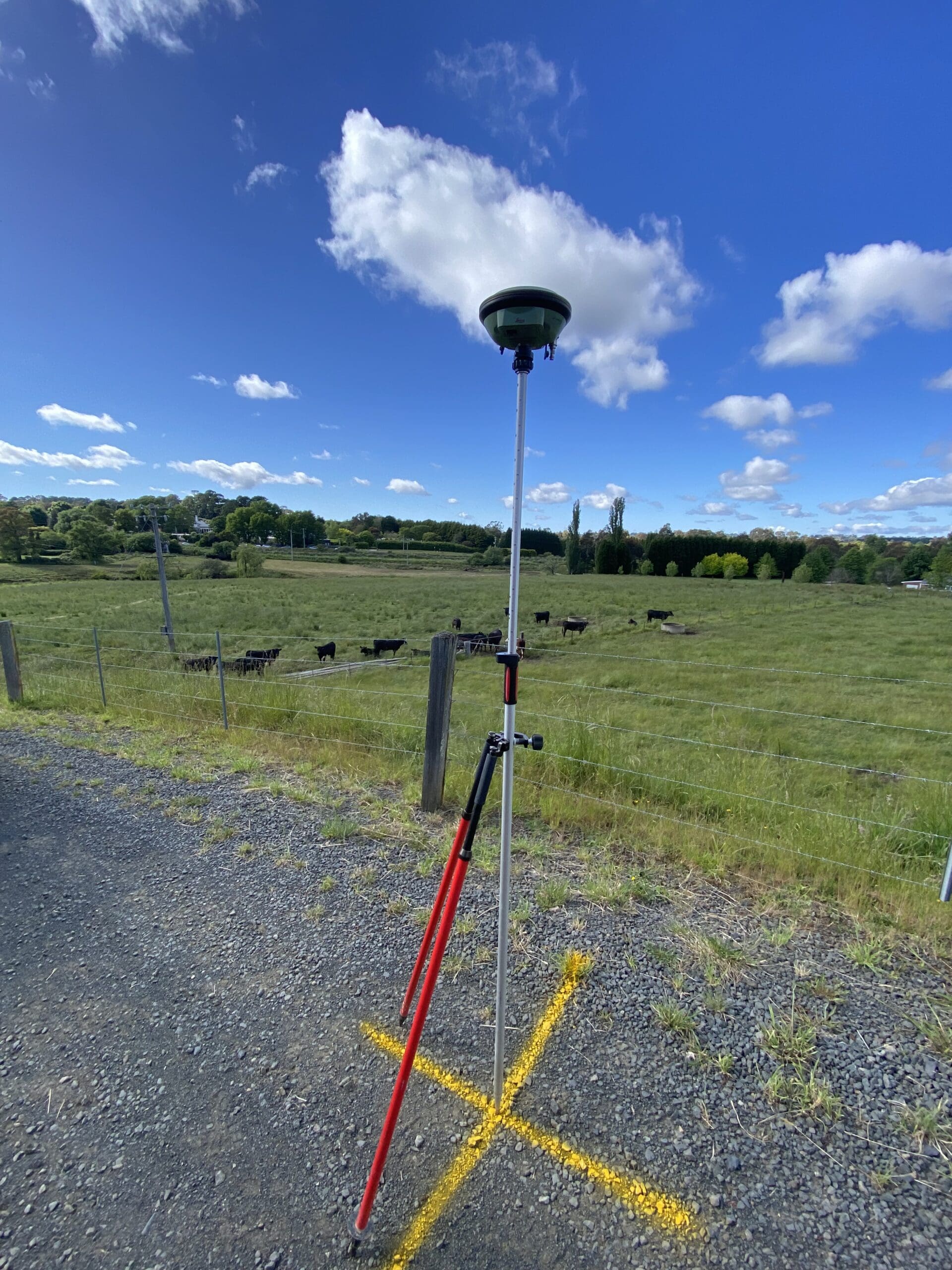
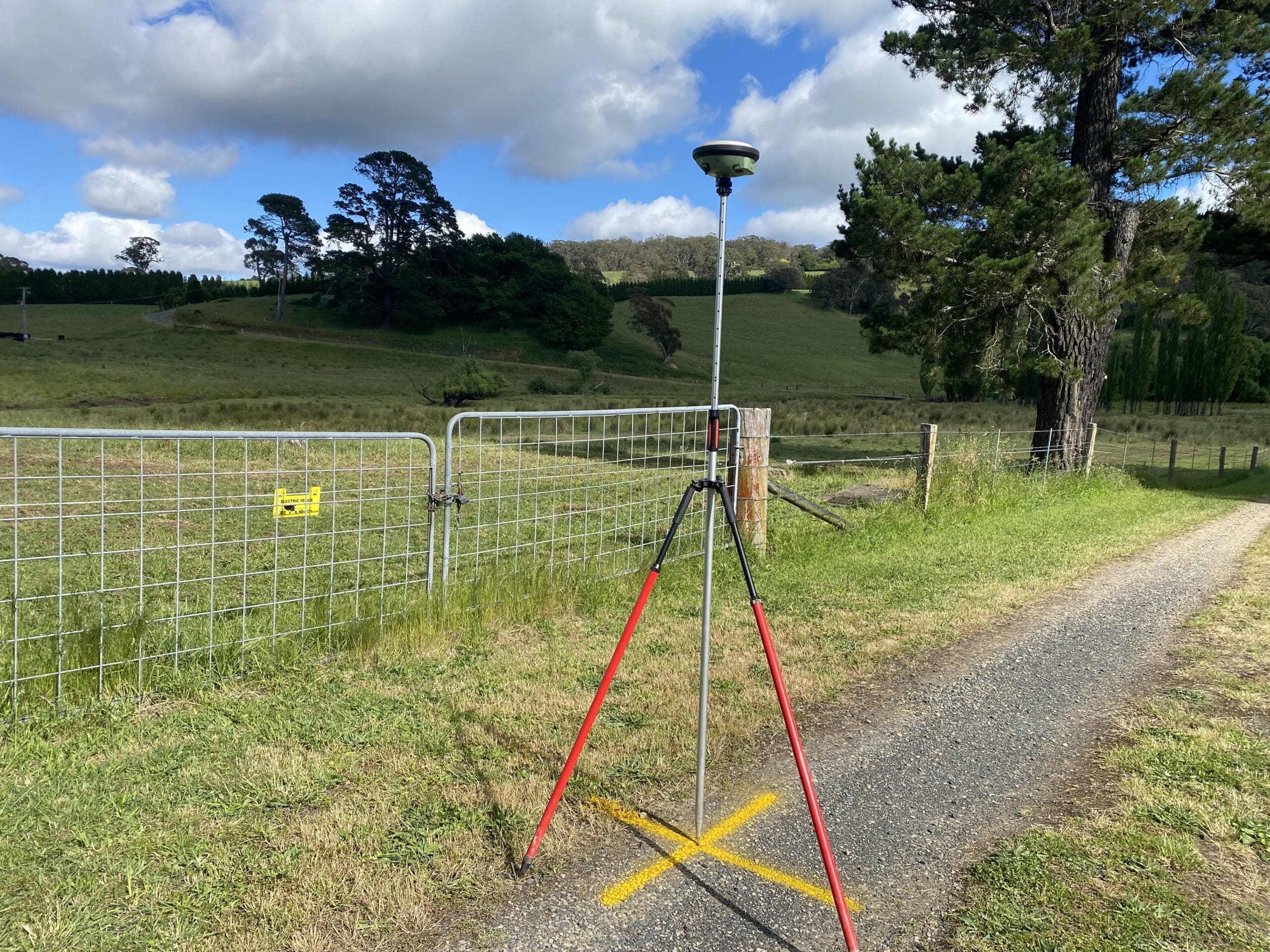
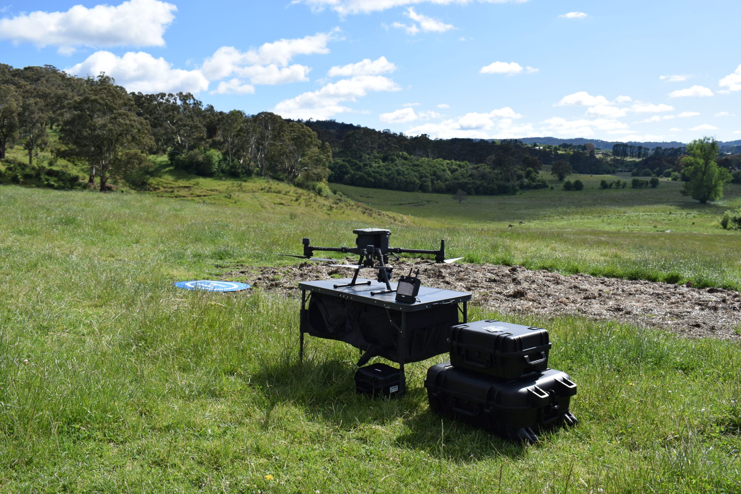
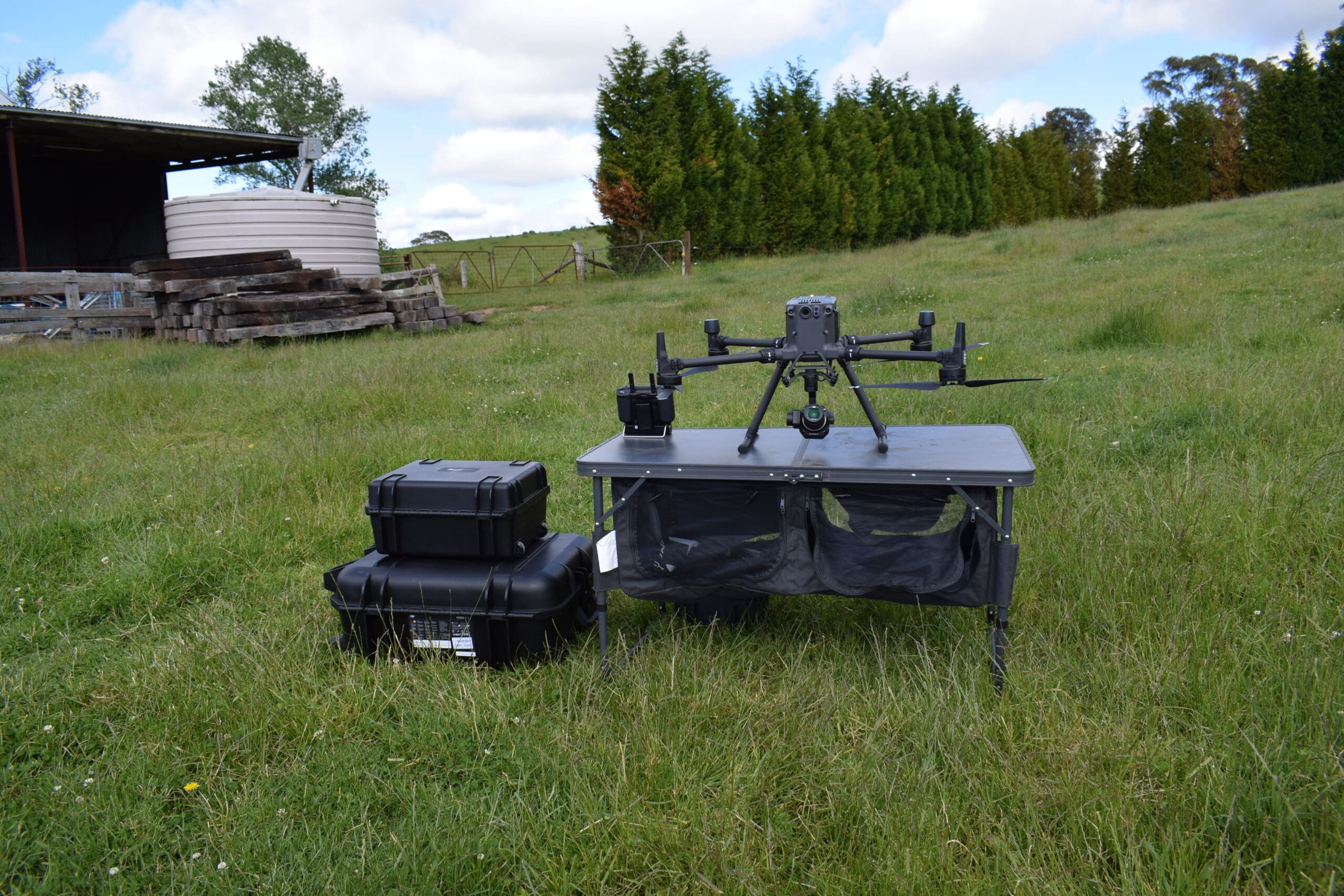
Road & Civil Surveys mobilised a UAV LiDAR and imaging platform to capture the full 100-hectare site in a single day of flying, supported by a ground control network established using survey-grade GNSS.
- UAV LiDAR captured a high-density point cloud across the full site, penetrating tree canopy, scrub and grassland to map the true ground surface — critical for accurate earthworks modelling in the heavily vegetated sections of the property.
- Simultaneously captured high-resolution aerial imagery was used to produce an orthorectified photomosaic, providing a current and detailed aerial view of the site for DA documentation and design overlay.
- A network of ground control points was established using survey-grade GNSS, tying all deliverables to MGA Zone 56 coordinates and Australian Height Datum (AHD) levels.
- The combined LiDAR and imagery dataset was processed to generate a bare-earth digital terrain model (DTM), digital surface model (DSM), contour plans and feature mapping — forming the spatial foundation for the civil engineering design and DA submission package.
The entire site capture was completed in a single day, with processed deliverables returned within the project timeframe.
Key Outcomes
DA-Ready Deliverables — Contour plans, terrain models and aerial photography delivered to the standard required for Development Application lodgement via the NSW Planning Portal, including supporting documentation for civil design, stormwater and bushfire assessment.
Vegetation Penetration — LiDAR pulses penetrated dense eucalypt canopy and undergrowth to map the true terrain surface across the entire holding, eliminating the need for vegetation clearing or manual survey through difficult bush.
Single-Day Site Capture — 100 hectares of complex, undulating terrain captured in one day of UAV operations, compared to an estimated three to four weeks of conventional ground survey across the same area.
Centimetre-Level Accuracy — Ground control and LiDAR processing delivered a terrain model with centimetre-level vertical accuracy, suitable for detailed subdivision layout, road design and earthworks volume calculations.
Complete Site Picture — The combination of LiDAR-derived terrain data and high-resolution aerial imagery gives planners, civil engineers and council assessors a complete spatial understanding of the site in a single deliverable package.
Project Snapshot
- 100 Ha Site Area Captured
- 1 Day Field Capture
- 30m+ Elevation Variation Across Site
- Centimetre Vertical Accuracy
Deliverables
- Classified LiDAR point cloud (ground, vegetation, structures)
- Bare-earth digital terrain model (DTM)
- Digital surface model (DSM)
- Orthorectified aerial photomosaic
- Contour plans at 0.25m and 0.5m intervals
- Feature mapping (fences, tracks, dams, structures, drainage lines, tree lines)
- Survey control report and coordinate schedule (MGA Zone 56 / AHD)
- Data formatted for direct import into civil design software (12d, Civil 3D)
Services Delivered
- UAV LiDAR survey
- High-resolution aerial imagery capture
- Survey-grade GNSS ground control network
- LiDAR point cloud classification and processing
- Digital terrain and surface modelling
- Contour generation and feature extraction
- Orthophoto production
- DA-supporting survey documentation