
Bridge Surveying and Inspection for Road and Rail Structures
Road & Civil Surveys surveys, scans and inspects bridges across New South Wales and Queensland: construction setout for new structures, 3D laser scanning and aerial inspection of existing ones, and monitoring where a structure is moving. We have worked on everything from 1860s wrought iron rail bridges to motorway twin bridges 68 metres above a river, usually without closing a lane.
Bridge Survey Services We Provide
A bridge is the tightest survey work on a civil project. Tolerances close up, access is awkward and the structure is often carrying live traffic or trains while you measure it. We cover the full sequence, from the first pile to the condition report years later.
Construction setout and conformance. Pile positions, pier and abutment setout, headstocks, bearing plinths, precast girder seating, deck levels and finished geometry, with conformance picked up at each stage before the next pour covers it.
As-built and bearing surveys. Recording the structure as it stands, including bearing positions, deck levels and clearances, for handover, for maintenance planning and for bearing replacement programs.
Aerial condition inspection. UAV capture of high resolution photography, video and LiDAR of piers, soffits, bearings and deck edges, giving asset engineers a full visual record without access platforms, rope crews or lane closures.
3D laser scanning and modelling. Terrestrial scanning of complex or heritage structures to produce point clouds and models that engineers can measure from and design against, particularly for bearing maintenance and rehabilitation.
Deformation and settlement monitoring. Repeat observation of targets on piers, decks and abutments to track movement over time, with data delivered in a form that supports the engineering assessment.
Clearance and deck surveys. Vertical clearance, deck profile and approach geometry for asset records and load assessments.
How We Inspect a Bridge
Every bridge job starts with what the engineer needs to see and measure. The method follows from that.
Planning and access
We confirm what the engineer needs, agree the capture method and plan around the structure: traffic, rail corridor access, water below, flight approvals and whether any of it needs a closure. Most of it does not.
Ground control
Control is established around the structure and tied to project datum, so aerial capture, scan data and conventional survey all sit in the same frame and can be compared with the previous survey or the original design.
Capture
UAV photography and LiDAR for the visual and geometric record, terrestrial scanning where detail matters, conventional survey for bearings, targets and levels. On a live structure we capture between movements and around possessions.
Deliverables
Condition photography indexed to the structure, point clouds, models, clearance and level schedules, and monitoring reports, delivered in the format the asset owner’s system needs.
Working Over Water, Rail and Live Traffic
The hard part of bridge work is rarely the measurement. It is getting to the structure. Piers stand in rivers, soffits sit metres above traffic, and the deck carries trains that do not stop for a survey crew.
That is why we lead with aerial capture and scanning on existing structures. A UAV can hold position under a deck and photograph every bearing on a pier in a fraction of the time an access platform takes, with no lane closure and no crew on ropes. A scanner on a footpath captures a heritage truss in an afternoon. Where conventional survey is still needed, for bearings and monitoring targets, we plan it around the traffic and the possession windows so the structure stays in service.
On construction, we embed with the contractor’s structures crew. Bridge setout runs to millimetres and the sequence is unforgiving: a headstock poured off line is not something you shim later. We pick up conformance at each hold point so the next stage is built on what is actually there.
Recent Bridge Projects
Bridge survey and inspection work we have delivered across New South Wales and Queensland includes:
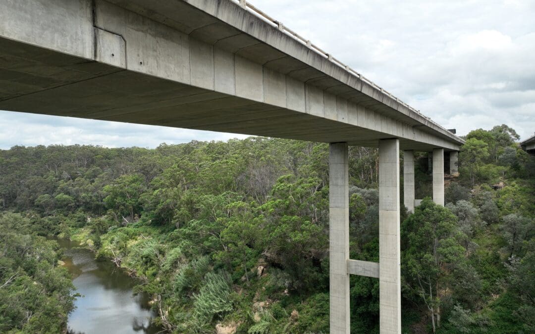
- Bridge Aerial Inspection and LiDAR Survey, Douglas Park: asset inspection and aerial LiDAR of the twin M31 Hume Motorway bridges over the Nepean River gorge, with the deck up to 68 metres above the water
- Railway Bridge Aerial Condition Assessment, Menangle: UAV photography and video of the 1863 Menangle Railway Bridge, the oldest metal rail bridge still in use in New South Wales
- Nepean and Lansvale Bridge Survey for Ventia: 3D laser scanning and modelling of the heritage listed Victoria Bridge at Penrith and the Lansdowne Bridge at Lansvale for a bearing maintenance and replacement program
- Port Botany Rail Duplication: construction survey on the new bridges over Southern Cross Drive and Mill Pond Creek and the rebuilt Botany Road bridge
- Albion Park Rail Bypass: embedded survey support across a motorway program that included 13 new bridges
Each of these was delivered to the asset owner’s or contractor’s inspection and conformance requirements.
Accuracy and Deliverables
Bridge data is only useful if it can be compared: this year’s inspection against last year’s, the as-built against the design, one pier against the next. So every capture is tied to control on project datum, and we keep that control from one visit to the next.
Aerial and scan data is checked against independent ground points before it leaves us, and the report states the accuracy achieved on the day rather than quoting the instrument specification.
Deliverables go out in whatever the engineer works in: indexed photo sets, point clouds, CAD, models for the digital engineering team, and clearance and monitoring schedules for the asset register.
Get Your Bridge Surveyed or Inspected
Whether you are building a bridge, maintaining one or trying to find out what condition it is in, talk to Road & Civil Surveys. We will look at the structure, the access and what the engineer needs, then recommend the capture method that gets it done with the least disruption. We operate from Gregory Hills in south west Sydney and Bundall on the Gold Coast, across New South Wales and Queensland. For aerial capture in more detail, see our UAV, photogrammetry and LiDAR surveys. For construction work more broadly, see road and civil construction surveying, or our full range of survey services.